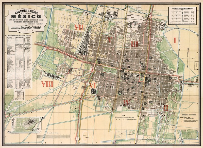

Historic 1886 Map General Plan of Administrative Divisions of Mexico City Poster
1886 Map: General Plan of Administrative Divisions of Mexico City. Detailed Specifications This is a Reproduction of the Original Map. This Map Comes in Sizes: 11"x15", 16"x22" and 23"x31.5" We have more Maps of Mexico in Our StoreAll Our Maps and Posters Are Made in the USA Plano general de indicacion de la Ciudad de Mexico. General plan of administrative divisions of Mexico City. Map is based on the official sources of the Mexican government. Shows new administrative division of the barracks, tourist attractions, mining, railroads, buildings, landmarks, both old and new street names are noted. Includes explanation and list of public buildings and establishments. This map comes with a white border around the image --------------------------- -How are the prints shipped? They are rolled and placed into a rigid tube. -Is this available in a larger/smaller size. Yes. For smaller or larger sizes, email us.
Specifications
| Return Shipping Will Be Paid By | Seller |
| All Returns Accepted | Returns Accepted |
| Item Must Be Returned Within | 30 Days |
| Region Of Origin | United States |
| Artist | Diaz de Leon, Francisco |
| Production Technique | Printed |
| Framing | Unframed |
| Country/Region Of Manufacture | United States |
| Subject | Maps |
| Culture | Does Not Apply |
| Style | Vintage |
| Color | Multi-Color |
| Quantity Type | Single-Piece Work |
| Year Of Production | 1886 |
| Material | Matte Paper |
| Theme | Does Not Apply |
| Time Period Produced | 1850-1899 |
| Medium | paper |
| Year | 1886 |
| Unit Of Sale | Single Piece |
| Listed By | Dealer or Reseller |
| Size Type/Largest Dimension | 23"x31" |
| Print Surface | Paper |
| Date Of Creation | 1800-1899 |
| Originality | Reproduction |
| Type | |
| Features | Unframed |
| Item Height | 3 variations |
| Item Length | 3 variations |
| Item Width | 3 variations |
| Unit Type | Unit |
What I notice about this print is the even ink distribution across the whole surface.