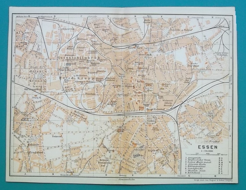
GERMANY Essen City Town Plan - 1912 MAP Baedeker 6 x 8" (15,5 x 20 cm)
Map Specifics: Type of print: Lithograph - Original antique map Year of printing: 1912 Publisher: Karl Baedeker Condition: 1 (1. Excellent - 2. Very good - 3. Good - 4. Fair). The map was originally folded in the middle by the publisher to fit into a travel guide. I carefully smoothed out the resulting fold/crease. The map virtually looks like it was never folded. Dimensions: 6 x 8 (15,5 x 20 cm) Paper weight: 4 (1. Thick - 2. Heavier - 3. Medium heavy - 4. Slightly heavier - 5. Thin) Reverse side: Blank Notes: Green color around the map in the photo is a contrasting background on which the map was photographed. The map may appear larger on your monitor than it is in reality, please check the dimensions. The map detail is much sharper than the photo of the map. Martin2001 Satisfaction Guaranteed Policy! Any print purchased from me may be returned for any (or no) reason for a full refund including all postage. Internet seller since 1998. Five-star service.
Specifications
| Return Shipping Will Be Paid By | Seller |
| All Returns Accepted | Returns Accepted |
| Item Must Be Returned Within | 30 Days |
| Refund Will Be Given As | Money Back |
| Maker | Baedeker |
| Features | Not framed |
| Listed By | Martin2001 |
| Printing Technique | Lithography |
| Original/Reproduction | Original |
| Type | Physical Map |
| Year | 1912 |
| Country/Region | Germany |
A nice touch is the decorative border on this limited edition art print.