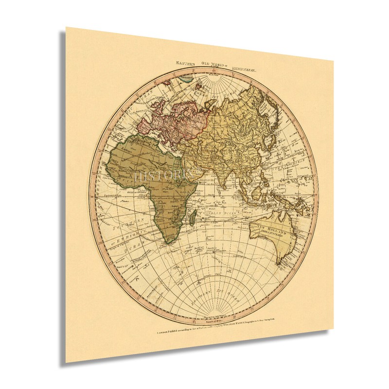


1786 Eastern Hemisphere World Map Poster - Vintage Eastern Hemisphere Wall Art
Feature Points VINTAGE MAP REPRODUCTION: You’ll love this high quality historic reproduction of 1786 Eastern Hemisphere Map. Our museum quality maps are archival grade, which means it will look great and last without fading for over 100 years. Our print to order maps are made in the USA and each map is inspected for quality. This beautiful artwork is a perfect addition to your themed decor. Vintage maps look great in the home, study or office. They make a perfect gift as well. MUSEUM QUALITY: This high quality map print will be a great addition to your vintage-themed wall. Don't waste money on cheap-looking, thin paper posters. We use thick, fine art print quality matte paper. Our professional’s choice matte paper displays artwork in high detail without glare. The color is vibrant and the text is easy to read. When framed, this map looks absolutely stunning. A LOOK BACK AT HISTORY: This is an impressive, historic reproduction of 1786 Eastern Hemisphere Wall Map. This print is from an original found in the maps and geography division of the US Library of Congress. A true piece of history. See our product description section for more fascinating information about this historic map and its significance. READY TO FRAME: This print includes a 0.2 inch border for a perfect frame fit and look. Our maps are designed to fit easy-to-find standard frame sizes, saving you money from having to pay for a custom frame. Each map is inspected for quality and shipped in a rigid tube. HISTORIX: We love history and art. Sometimes old maps have tears, folds, separations and other blemishes. We digitally restore and enhance maps while keeping its historical character. All our maps are proudly made in the USA. Customers all over the world love our vintage maps and we know you will too. Additional Information Produced and published by noted English engraver and cartographer William Faden, this unique depiction of the Eastern Hemisphere immediately transports the viewer back in time. It creates an indelible link between the present and past. Faden was the Royal Geographer to King George III, and his role was to supply maps to Parliament and the Crown. His self printed North American Atlas, published a decade prior, documented the battles of the American Revolution became one of the most important atlases of the eighteenth century. It included 29 maps with detailed illustrations of battles drawn by eyewitnesses. Faden’s works were noted for their accuracy and detail. With the extensive exploration of the Eastern Hemisphere occurring throughout the seventeenth and eighteenth centuries, these maps became more accurate, allowing English residents a glimpse of the world outside of the British isles. The 1780s were a transitional period between the Age of Enlightenment and the Industrial Revolution and saw the development of modern philosophy. The Industrial Revolution saw the abandonment of traditional agrarian society, and the rise of urbanism and city populations began to rise. The rise of republicanism in favor of conventional monarchies was also spurred on by the American Revolution and the fall of the Bastille. King George III reigned during a period of significant military conflict not only in the American Colonies but also against Napoleonic France. Great Britain became the dominant power in Europe under his rule after the French defeat in the Seven Years War in 1763. Our museum quality giclee print comes printed with archival ink on premium heavyweight matte paper. Shipped in a sturdy cardboard tube your print will arrive ready to be framed. This eye-catching vintage map reproduction print makes the perfect gift for anyone that loves history and imagery.
Specifications
| Return Shipping Will Be Paid By | Seller |
| All Returns Accepted | Returns Accepted |
| Item Must Be Returned Within | 30 Days |
| Type | Wall Art |
| Subject | Maps and Photographs |
| Features | Museum Quality |
| Theme | History |
| Artist | Various |
| Style | Vintage |
| Region Of Origin | Made in the USA |
| Framing | Unframed |
| Brand | HISTORIX |
You will notice the fantasy style gives this artwork a sense of wonder and escape.


